Association Gives Winnipeg’s Bike Trails Their Close-Up on Google Maps
The Winnipeg Trails Association is wheeling its way through the city’s many bike trails using a specialized device that will put Winnipeg's car-free pathways on Google Maps’ Street View in the coming months.
Technically, Winnipeg’s bike trails aren’t “streets,” but they’re getting the Google Street View treatment anyway—with an association’s help.
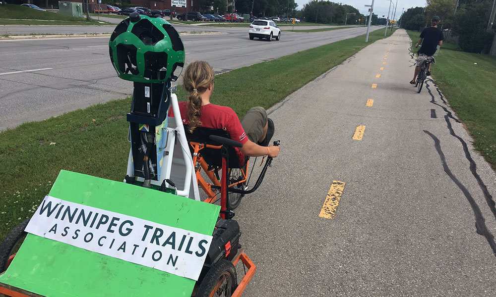
The Winnipeg Trails Association has been working on a 360-degree mapping of the city’s many bike trails to give pedalers an accurate view of its biking landscape. WTA is using Google Street View Trekker, a specialized camera for capturing natural elements, to map the trails.
That puts WTA in some interesting company. The Trekker tool was first used on the Grand Canyon and has since been used at the Pyramids of Giza in Egypt, the Mount Everest Base Camp in Nepal, and numerous other fascinating locations.
WTA is using a Trekker camera attached to a recumbent bicycle and plans to capture every bike trail in the city, said Marina Herscovitch, a trails analyst for the association, in comments to CBC News.
Gorgeous day out here in #ambertrails ! #Kildonanpark, I'm coming for you next! @WinnipegTrails pic.twitter.com/GfRAd7tRsT
— Marina Herscovitch (@MarinaHersky) August 7, 2017
“They wanted to focus on the major bike trails in Winnipeg, but we thought it was best we get as much as we can,” she said. “I suppose people don’t realize how big Winnipeg has become.”
According to Canadian Cycling Magazine, WTA is relying on a dozen volunteers to capture the city’s bike trails in 10-hour shifts before it has to return the camera to Google on August 17.
The 360-degree views are expected to show up on Google Maps sometime in the next year.
(via WTA's Twitter account)
Ernie Smith is a former senior editor for Associations Now. MORE
Got an article tip for us? Contact us and let us know!


Comments